Freshwater-Budget
Freshwater budget and salinity variability in the subpolar and suptropical gyres of the North Atlantic
(DFG Research Unit FOR 1740, TP 1.2)
Funding: DFG
Period: 2016 - 2019
|
|
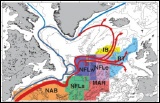
In the first phase, high spatial (0.25° x 0.25°) and temporal (daily) resolution salinity time series (1992 - 2012) in the upper 700 m were constructed using Argo data and satellite altimetry. |
|
|
The objectives of the continuation proposal are based on the results of the first phase, and we will (i) analyse the monthly to multi-annual variability in the regional salinity contents; (ii) study the evolution and variability of surface and subsurface structures of fronts, meanders, and eddies, (iii) check whether the salinity reconstructions are valid in regions shallower than 1900 m depth in the Northeast Atlantic, and test whether the quality of the reconstructions of the salinity profile improve by adding satellite observations of surface salinity. |
|
|
printer friendly page |
(C) 2019 - All rights reserved